
Bangalore to Mananthavady via Nagarhole
Bangalore -- 150km --> Mysore -- 45km --> Hunsur -- 20km --> Nagarhole entry gate -- 30km --> Nagarhole exit gate -- 4km --> Kutta -- 18km--> Kattikulam -- 10km --> Mananthavady
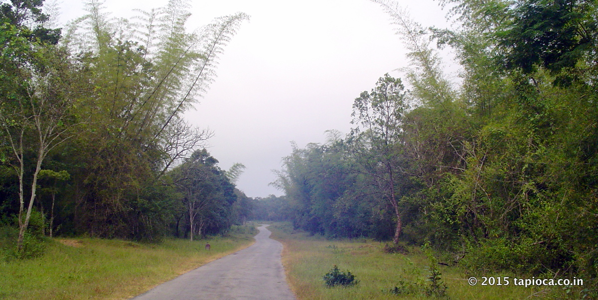
Road to Kutta through Nagarhole NP
Road to Kutta through Nagarhole NP
R
oute via Nagarhole and Kutta is a longer but feasible route to drive to Wayanad from Bangalore.Select this route if your destination is around the northern part of Wayanad (like Thirunelly, Tholpetty, Kutta etc).
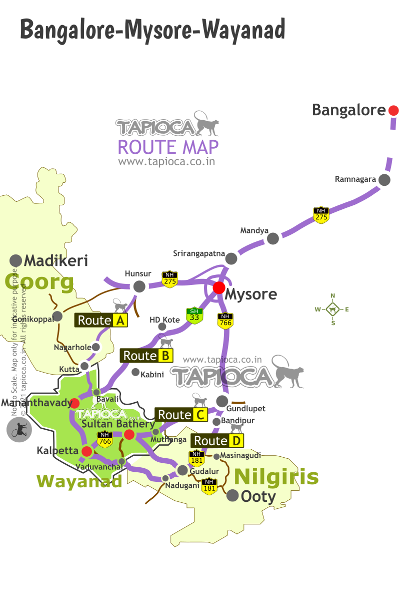
Like the Route B & C to Wayanad (via HD Kote or Bandipur ), the Route A via Nagarhole-Kutta too is in the direction of Mysore (see Bangalore to Wayanad Map Below).
For easy understanding let's divide the driving into 6 parts.
1. Getting out of Bangalore city.
2. Bangalore to Mysore drive.
3. Bypass Mysore City.
4. Mysore to Hunsur.
5. Hunsur to Nagarhole forest and Kutta (Karnataka-Kerala border).
6. Kutta to Mananthavady.
Getting out of Bangalore and Drive to Mysore
In about 150km (4 hours), you'll reach the periphery Bangalore. For the Bangalore- Mysore stretch see the Bengaluru-Mysuru route details here.
Bypass Mysore City
In this route you can skip Mysore city (unlike the Route B & C )
If you have specific itinerary reason to enter the city, drive through Mysore city.
Otherwise take one of the two detour options to bypass Mysore detailed below.
The first option is to take the diversion after Srirangapatna. Leave the highway and enter the road that appears on your right after Srirangapatna town.
You can easily notice two large bridges across Kaveri River, one just before you enter and the next just after you exit Srirangapatna town. Both are fairly long bridges. After the second bridge, you'll see a third bridge, a short one ending with a roundabout junction.
At this junction you'll see a plethora of billboards and signages directing you to Coorg,Madikeri etc.
This is the road you need to take to reach KRS (Brindavan Gardens) and Ranganathittu Bird Sanctuary located near Mysore.
This bypass road rejoins the NH275 ( locally called Hunsur Road , old SH88) at Elivala (Yelwal), way after Mysore city. This bypass route is about 16km between Srirangapatna and Elivala.
It is a decent 2 lane road, but no way comparable to the highway you have been before the deviation.
By the way, Ranganathittu Bird Sanctuary is a 1km detour on this route. This is a popular detour itinerary among those driving between Bangalore and Coorg/Wayanad. Consider about 1 to 2 hours for a quick tour of the sanctuary.
At Elivala you are now back on the highway (NH275) again. About 30km on NH275 from here, you'll reach Hunsur town.
The second bypass option is to take the Mysore Outer Ring Road. For this you need to keep continue on the NH275 at the roundabout junction mentioned above towards Mysore City. In about 7km, you'll see a police checkpost with barricade on the highway and the Varuna Canal (a bridge like structure above the highway), crossing the highway. The ring road junction is just ahead. Take the right at the signal.
After 10km, the ring road again crosses the NH275 (Hunsur Road). Take the right diversion ( towards Hunsur,Madikeri etc)
Mysore to Hunsur
The road from Mysore to Hunsur is as marvelous, even better than the Bangalore-Mysore stretch of the highway.Traffic is usually . It’s 4 lanes most of the way.
As you approach Hunsur, the highway makes a Y fork. Take the left (rather straight fork, as the highway bends rightward). At the junction, there is a huge board indicating the direction to the wildlife sanctuary. You’ll reach the crowded Hunsur bus station area.
This crowd announces the end of super-fast driving pleasure. Look out for a narrow road on your left right after the bus station. You may even spot a tiny signboard showing direction to Nagarhole and Iruppu Falls.
If in doubt, ask for direction to Nagarhole or Kutta (Do not ask for Wayanad , as you may not get a quick or right answer from a layman by the road side).
On the other hand, if you do not take the Nagarhole road diversion, the main road leads to Gonikoppal, from where too you can head to Wayanad, but it's a long detour.
Hunsur to Nagarhole Forest and Kutta town
Before you setout on the Nagarhole Road, keep a note of a few things. The next town of any significance is Kutta, 2 hours drive away. And you'll drive through remote rural area and a solitude forest, with no wayside facilities (even with no mobile signal for long periods).
Hunsur has fuel stations and ATMs. Cafe County (on the right of the Y fork mentioned above) is a pretty decent highway side restaurant with facilities.
Back to the Nagarhole Road. In about 20km from Hunsur, you'll reach Now you are on the road from Hunsur to Kutta, via Nagarhole forest (a.k.a Rajiv Gandhi National Park ).
Just before entering the forest, on your right are two resorts: The King's Sanctuary and Jungle Inn (not to be confused with the Jungle Lodges by JLR).
The road has a gate across it with the check post office next to it. You need to enter the register (Details like vehicle's registration number, your name, destination, number of passengers, etc;). You've right of way. No fees to be paid.
The road is in reasonable condition with humps built across the road every few kilometers. One is expected to drive slow as wild animals may cross the road at any point across your road. Somewhere in the middle, you will pass a few tribal settlements, the old Murkal Elephant camp and the Nagarhole safari point before you exit the forest.
There are conditions to drive through the forest. Do not park your vehicle inside the forest. Keep driving at the prescribed speed. Do not venture out of the vehicle. Keep distance if you spot wildlife crossing the road. No honking. Do not feed wildlife etc.
What if you spot wild animals on the road? It is not uncommon to see herds of elephants cross the road. First of all, you should not provoke the animals nor feel panicky. Stay calm and keep the distance. Do not get out of your car or honk. Wait till they just fade away into the bushes and give you way.
While most of the animals are shy, they can be aggressive when they are provoked. Bisons and elephants are known to charge, if provoked. Keep in mind it is no zoo or safari and no one will be around there to help, should a situation arise.
It takes about an hour till you reach the other end of the forest (and yet another check post with same set of formalities!). Now you are officially out of the Rajiv Gandhi National Park.
A few turns later you reach the small border town called Kutta.
Between Hunsur and Mananthavady, Kutta is the only place where you can get some facilities (such as water, food and toilets). Look for a steep left turn as you enter Kutta. This is the road that goes to Wayanad again through a forest, though it is not as isolated as Nagarhole forest range. If you want to take a pitstop, head into Kutta town without taking the left fork mentioned above. The town square is about half kilometer from the fork.
Kutta to Mananthavady
You'll enter Kerala soon after Kutta. A signboard in Malayalam announces that you are entering Kerala state. The road, in the Kerala side of the forest, is wider than the one through Nagarhole. So is the traffic.
You are now very well into Wayanad. However terribly you’ve fared in those geography classes, you can easily tell now that you are in the lap of the evergreen misty Western Ghats.
In a few minutes drive, you will pass the entrance of Tholpetty Wildlife Sanctuary (part of Wayanad WLS). You can spot a large number of tourist vehicles parked on either side of the road and the traffic on the main road literally wriggles through this crowd. This sanctuary is the first attraction in Wayanad as you enter the district by this route.
A few kilometers ahead from the sanctuary gate, still on the forest road towards Mananthavady, you will reach a junction.This is the Thetroad junction.
Take the right fork to go towards Thirunelli Temple, Papanashini or to Pakshipathalam (trek to forest for bird watching). Thirunelli about 15 kilometers from the junction.
At the the Thetroad junction you can notice many vehicles parked in front of a makeshift cum kitchen. This is Kuttettan's Unniappam shop, a local fame for the oilfried snack (Unniappam).
Ahead on the road towards Mananthavady the forest thins out and the environs appear to be more populated, you’ll arrive at a small town called Kartikulam.
Just before that you'll spot the left deviation towards Kuruva Island (6km through the forest, again!); continue straight on the highway for Mananthavady town (10 kilometers).
Kattikulam is the first major town in Wayanad on this route. Kattikulam has a fuel station and a few restaurants. The route to Wayanad via HD Kote too joins the main road at Kattikulam.
Bus services to Wayanad via Kutta
There are a few KSRTC bus services from Bangalore to Kutta and Gonikoppal.
Bus is a great travel option for those heading to the homestays and plantation stays around Kutta and Gonikoppal. Whitewater rafting at Barapole (KKR) is nearby. Hire a jeep from Kutta or Gonikoppal for local travel.
This region is the ideal base for adventure tourism in Coorg.
Wayanad
Bangalore-Mysore-Coorg-Wayanad-Ooty Route Map