
Bangalore to Munnar
Munnar
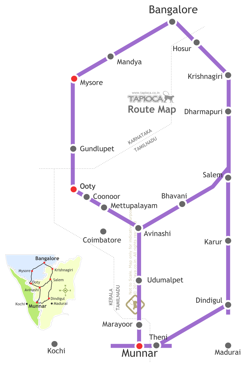
Bangalore to Munnar via Salem-Bhavani: Distance 480km Bangalore to Munnar via Mysore & Ooty: Distance 560km. Dindigul-Theni Route ( Munnar from Bangalore via Dindigul: Distance 550km
Munnar is about 450 km south of Bangalore. It is basically a plantation town in Kerala located close to the Kerala Tamilnadu border, on the rolling hills of the Western Ghats. Sprawling over many hills and estates , a large part of Munnar's tea gardens are owned by Tata Tea. The famous Kannan Devan brand of Tata is named after the Kannan Devan Hills of Munnar.
N
ow talking about the options to reach Munnar from Bangalore, you have broadly three choices - the road, rail and air. We'll see the road option later as it has many routes to chose from.The nearest airports for Munnar are Coimbatore (in Tamilnadu) and Cochin (in Kerala). However both are good 3 to 5 hours drive further anyway. From Cochin airport Munnar is about 100 km, that is approximately 3 hours drive via Kalady, Perumbavoor, Muvattupuzha, Kothamangalam, Adimali and finally Munnar.
From Coimbatore airport, Munnar is about 5 hours drive (about 160km).
Thanks to the hilly nature of the roads closer to Munnar the driving time is a bit longer for the given distances.
Regarding the choices of flights, Cochin has better direct connectivity with Bangalore ( about 10 directs flights) where as Coimbatore has about 2 daily flights from Bangalore. So that about the itinerary involving the flight connectivity between Bangalore and Munnar.
If you are thinking of rail connectivity, that too resembles the above mentioned itinerary since you've to get down first at Coimbatore or Ernakulam. Those are the nearest railheads for Munnar.
There are three daily trains from Bangalore To Coimbatore - The Coimbatore Express (Train No.1013), Kanyakumari Express (Train No: 6526) and the Ernakulam Express ( Train No. 2677). Trains take about 7 hours to reach Coimbatore from Bangalore. Further the road connection from Coimbatore to Munnar is as mentioned earlier.
There are some direct bus services to Munnar from Coimbatore. If that is not available catch a bus to Udumalpet. Go the Ukkadam bus stand in Coimbatore city for bus connections. There are frequent buses (private and state run) from Coimbatore to Udumalpet. The Coimbatore to Udumalpet bus journey is about 1.5 hours to 2 hours. From Udumalpet you can get a bus to Munnar (leaves in every 1 hour or so). Udumalpet to Munnar is about 3.5 hours by bus. So it is roughly a 5 to 6 hours affair getting you to Munnar from Coimbatore by bus.
Bangalore to Munnar by Train: Back to further train options. Two of the above mentioned trains ( Kanyakumari Express and Ernakulam Express ) are options to reach Ernakulam also. If you have no reason to head towards Ernakulam(city), get down at Angamali (AFK) or Aluva (AWY) ahead of the Ernakulam Town (ERN) station. Practically you will save some 30km road distance as compared to traveling from Ernakulam to Munnar.
In either way you can opt for private buses of the state operated (KSRTC) to Munnar. The route followed from Ernakulam is :Ernakulam, Vytila,Thrippunithura, Kolencherry, Muvattupuzha, Kothamangalam, Adimali, Aanachaal, Munnar. If a direct bus is not available readily, you can explore the possibility of a bus service to an intermediate point, most likely to Kothamangalam. From Kothamangalam you can get a bus connection to Munnar.
Similarly , if you are getting down at Angamaly or Alway (Aluva) ,the bus route to be followed is : Angamaly, Kalady, Perumbavoor, Kothamangalam, Adimaly, Aanachaal, Munnar. Here again, if a direct bus is not available, catch one to an intermediate point.
Of course you can hire a car from Aluva,Angamali or Ernakulam for Munnar. So that's about the train options for Munnar from Bangalore.
Bangalore to Munnar by road: There are many routes for Bangalore to Munnar, depending on a host of other travel considerations. Here we'll see a few popular options. Bangalore to Munnar is about 500km drive (about 12 hours ) , with some variations depends on the routes you select. The distance quoted in the following are approximate.
Bangalore to Munnar via Udumalaippettai:
Bangalore > Hosur > Krishnagiri > Dharmapuri > Salem > Perundurai > Avanashi > Udumalaippettai > Marayoor > Munnar
You will be driving on the NH-7, NH-47 and SH-97(Tamilnadu) during most of the journey and then cross Indira Gandhi National Park to enter Kerala at the Chinnar Wildlife Sanctuary. Of course the route mentioned above have many alternate roads and bypasses to skip many towns.
So let's look at the first stretch of this route, that is from Bangalore to Salem. The first task from Bangalore is to get is to get to NH 7. Basically you've to head towards the southeast of Bangalore city ( towards Koramangala, Electronics City ) to join NH-7. You can even take the NICE road to join NH-7. Now head towards Hosur on HN -7. From Hosur you have two options, the first is to continue on the 'swanky' NH-7 itself towards Salem or take a less busy road ( SH-17 ) via Rayakottai and Palakodu to join the HN-7 again after Dharmapuri.
Though fast moving with 4 lane, the traffic on NH-7 ( Hosur > Krishnagiri > Dharmapuri stretch ) is a bit busy with racing buses and too many trucks.
If you are looking for a relaxed driving take the Rayakottai - Palakodu route. The route is more scenic and rural. It's a bit shorter too than the other route, but doesn't make it faster.
So whichever option you've taken, from Dharmapuri onwards you are on NH-7 all the way up to Salem. You would have crossed Thoppur and Omalur on the way before Salem. The Bangalore to Salem stretch is about 200km. It could take anything from 3 to 4 hours of driving for this stretch.
At Salem you'll leave the NH-7 and take the NH-47. In fact you will not be entering the Salem city as the bypass around the city connects you to the NH-47. It is a very busy bypass road ( 6-lane) around the periphery of Salem city. Aks for the Kondalampatti Junction where you can turn right towards the NH-47.
Your next diversion point on NH-47 is after a town called Avanashi. This is at about 100 km from the Salem bypass. You will cross the Bhavani , Chithode and Perundurai towns before reaching Avanashi town. At Avanashi ask for the Udumalpet (Udumalaippettai) road (SH-166). That is you leave NH-47 by taking a left turn ( into SH-166) after Avanashi town towards Udumalpet.
Another 70 km straight south from Avanashi, you will reach the Udumalpet town, after crossing Mangalam and Palladam. Alternatively, while on NH 47 , a shortcut to reach Palladam ( you will skip Avanashi) is to take the left deviation at Perumanallur. This road goes via Tiruppur and joins the Udumalpet road at Palladam. You'll save some 10km in this shortcut.
Another alternative route between Perundurai and Udumalpet is via Dharapuram. At Perundurai leave NH 47 for Udumalpet via Kangeyam and Dharapuram (bypass).
Udumalpet to Munnar, the final lap, is about 90km long. From Udumalpet town ask for the Munnar road. A few minutes later the chain of mountains appears in the horizon. You are shortly in for a long drive through the forests of Western Ghats. After Udumalpet town The road is typically narrower with umpteen curves, turnings and steep climbs till you reach Munnar.
About 30km from Udumalpet on the fringes of Indira Gandhi National Park (Tamilnadu) is the Chinnar Wildlife Sanctuary (Kerala) , the entrance to it marks the Tamilnadu Kerala border. You needs to complete some formalities at the check post ( checking the vehicle/baggage, entering details in the register etc ) before entering the wildlife sanctuary. Munnar is some 60km from Chinnar Wildlife Sanctuary. Its a 10-12 kilometers drive through the sanctuary and then the road pass through a thick canopy of bamboo forest. As you exit the sanctuary, you'll reach a small town called Marayoor. Beyond the tea plantations starts. Now those classic images of rolling hills with tea gardens keep appearing till you reach Munnar town. Marayoor to Munnar is about 40 km. Somewhere midway between Marayoor and Munnar is Anamudi in the Eravikulam National Park. This is the highest peak (2695 meters / 8842 ft ) in South India and of Western Ghats.
Well, you've just crossed the home to the largest surviving population of Asian Elephants, and the Nilgiri Tahr, which not found elsewhere in India. That is in addition to a host of other wildlife including Bisons, Tigers and antelopes.
In short you will pass the Anaimalai Wildlife Sanctuary ( Indira Gandhi National Park), Chinnar Wildlife Sanctuary and Eravikulam National Park before reaching Munnar Town. Udumalpet to Munnar is about 60 km.
So that's about the so called Bangalore - Hosur - Salem - Udumalaippettai - Munnar route.
Bangalore to Munnar via Chamarajanagar: This is the Bangalore > Kanakpura > Kollegal > Chamarajanagara > Sathyamangalam >Avanashi > Udumalpet > Marayoor > Munnar route.
The last laps of Route 2 (from Avanashi onwards) is identical to that of Route 1. That is the 70 km Avanashi to Udumalpet and the 60 km high range ( hilly/forest ) stretch from Udumalpet to Munnar. So we'll see the rest of the Route 2, that is from Bangalore up to Avanashi.
The route is something like this: Bangalore > 50 km > Kanakapura > 48 km> Malavalli > 35km > Kollegal > 40km > Chamarajanagara > 75 km > Sathyamangalam > 40 km > Annur > 18 km >Avanashi .
From Bangalore all the way to Sathyamangalam ( Sathy) you are on NH 209. From Bangalore city head southwards and ask for the Kanakpura Road. This is nothing but the NH-209. This is not a busy highway like NH-7, but it passes through many towns and villages.
You will be crossing the Karnataka Tamilnadu border between Chamarajanagara and Sathyamangalam. This is a forest stretch with more than 2 dozens of hairpin bends with steep downhill road ( for about 20km stretch), though the road is in good condition. You could spot wildlife , especially during the early mornings and in the evenings. The road after Chamarajanagara is practically empty except for the odd interstate buses and the slow moving trucks laden with sugarcane heading towards the distilleries in Tamilnadu. Between Chamarajanagara and Sathyamangalam there are not big travelers conveniences (restaurants, toilets, shops etc ). And it is a 2 hour stretch . So plan your break accordingly.
The Ghat section starts at a small village in Dimbam ( with a couple of tea stalls and a fuel station) and ends at Bannari after some 21 hairpins that appears one after another . From Dimbam you can see the highland drops the height abruptly and the vast stretch of Deccan plateau as far as eye can see. Also you can spot the Sathyamangalam town somewhere in the middle of the plateau. The whole thing is like a view from the an air plane's window. If you want to enjoy the sight, do it at Dimbam , the highest and convenient view point. Beyond this, there are no practical place to park the vehicle to catch the view since the width of the road is just enough for the two way traffic. Also it is dangerous to stop anywhere in between.
Blow horn well before all the hairpins; if returned with a horn, stop the vehicle well before the bend ,giving priority for the opposite traffic. In other words if two vehicles meet at the hairpin, it is difficult to proceed, especially if one of it happened to be a heavy vehicle. In such a situation uphill vehicle gets the priority in negotiating the bend first, while the downhill vehicle stops well before the bend, leaving space for the oncoming vehicle to turn. Also it is impossible (and dangerous too) to overtake vehicles in the ghat section. Keep your patient in top gear for that 20 km stretch , even if a smoke belching truck is crawling at an awfully slow pace ahead of you. Follow till they give way or reach the plane road after the ghat.
Its a wide and well maintained road all the way to Sathyamangalam and further. Sathyamangalam is a busy town and you've to wriggle out of it. If in doubt ask for the direction towards Coimbatore.
After about 40km from Sathyamangalam you will reach a place called Annur, where you have to take a deviation for Avanashi. Annur is a small village and you would easily slip past this without noticing the deviation, though the places are well marked with signposts. Ask for Annur and for the road to Avanashi. It's a steep left turn, that is not obvious from a distance. If you miss this, you are on your way to Coimbatore city (some 30km from Annur). You can reach Udumalpet via Coimbatore, but it is a bit longer and more importantly you've to cross the busy Coimbatore city.
From Annur head towards Avanashi (about 18km). This is a narrow but driveable road.Near Avanashi this road joins the NH-47. From Avanashi to Munnar, follow the route as explained in Route 1.
Another route ( Route 3) one can consider is via Mysore. That is get to Mysore ( see: Bangalore to Mysore by road ) by the Bangalore-Mysore state highway ( SH17). From Mysore head towards Gundlupet (NH 212 / Ooty Road ). At about 23 km from Mysore you'll cross Nanjangud town. Take a left deviation here (even there is a bypass , just before the town) for Chamarajanagara. From Chamarajanagara onwards the route is same as that of Route 2.
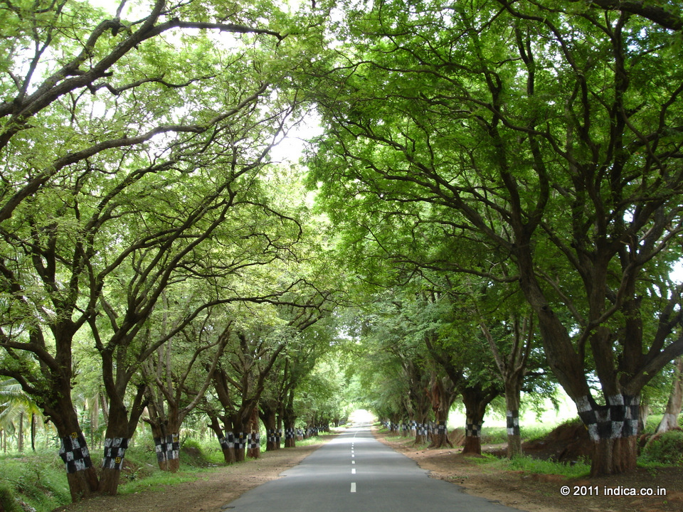
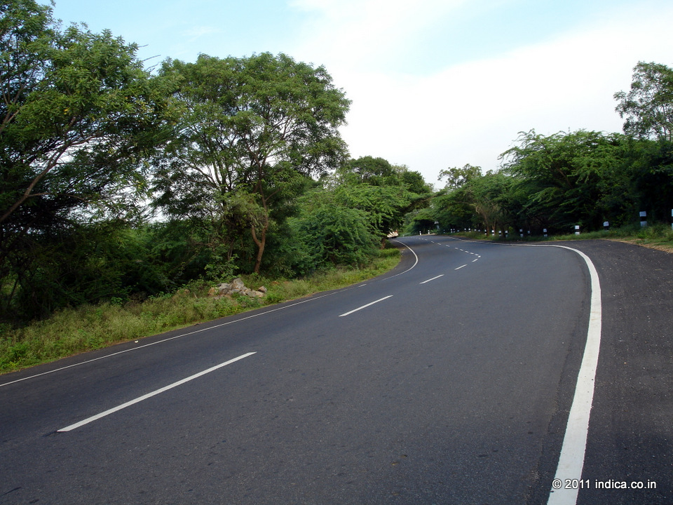
Tamarind lined road near Udumalpet
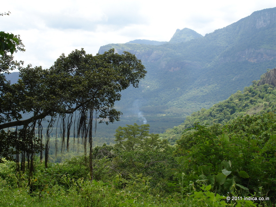
Near Anamudi
Near Anamudi
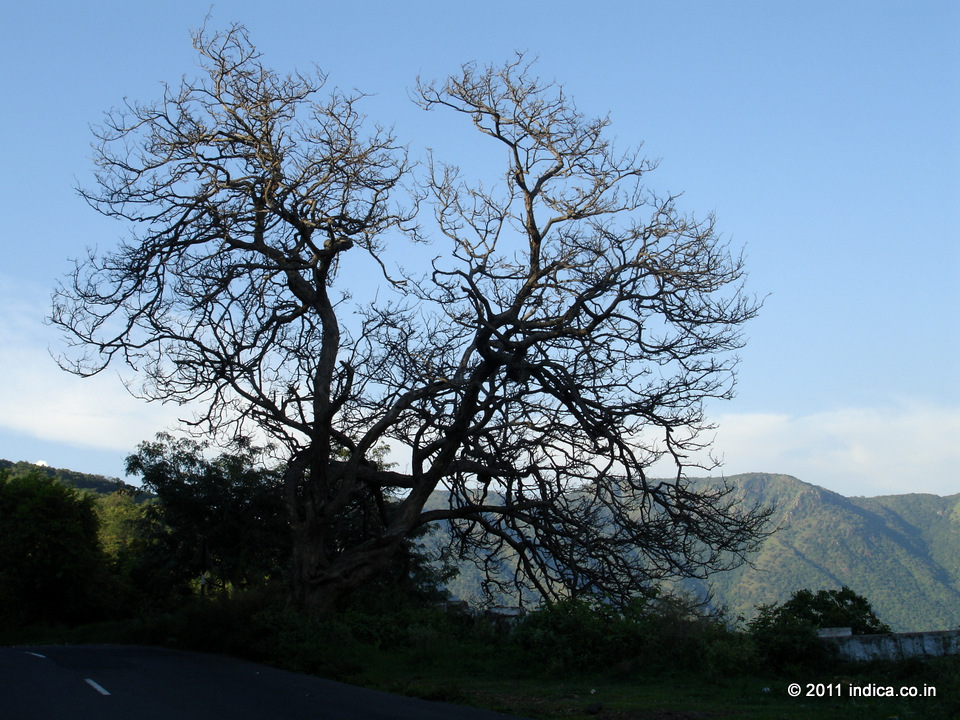
View from Dimbam, before the hairpins start
View from Dimbam, before the hairpins start
At Bannary the road gets straight suddenly and you can zoom to makeup what is lost in the ghat section driving.
At Bannary the road gets straight suddenly and you can zoom to makeup what is lost in the ghat section driving.
Tamarind lined road near Udumalpet
Near Udumalpet
Near Anamudi
View from Dimbam, before the hairpins start