
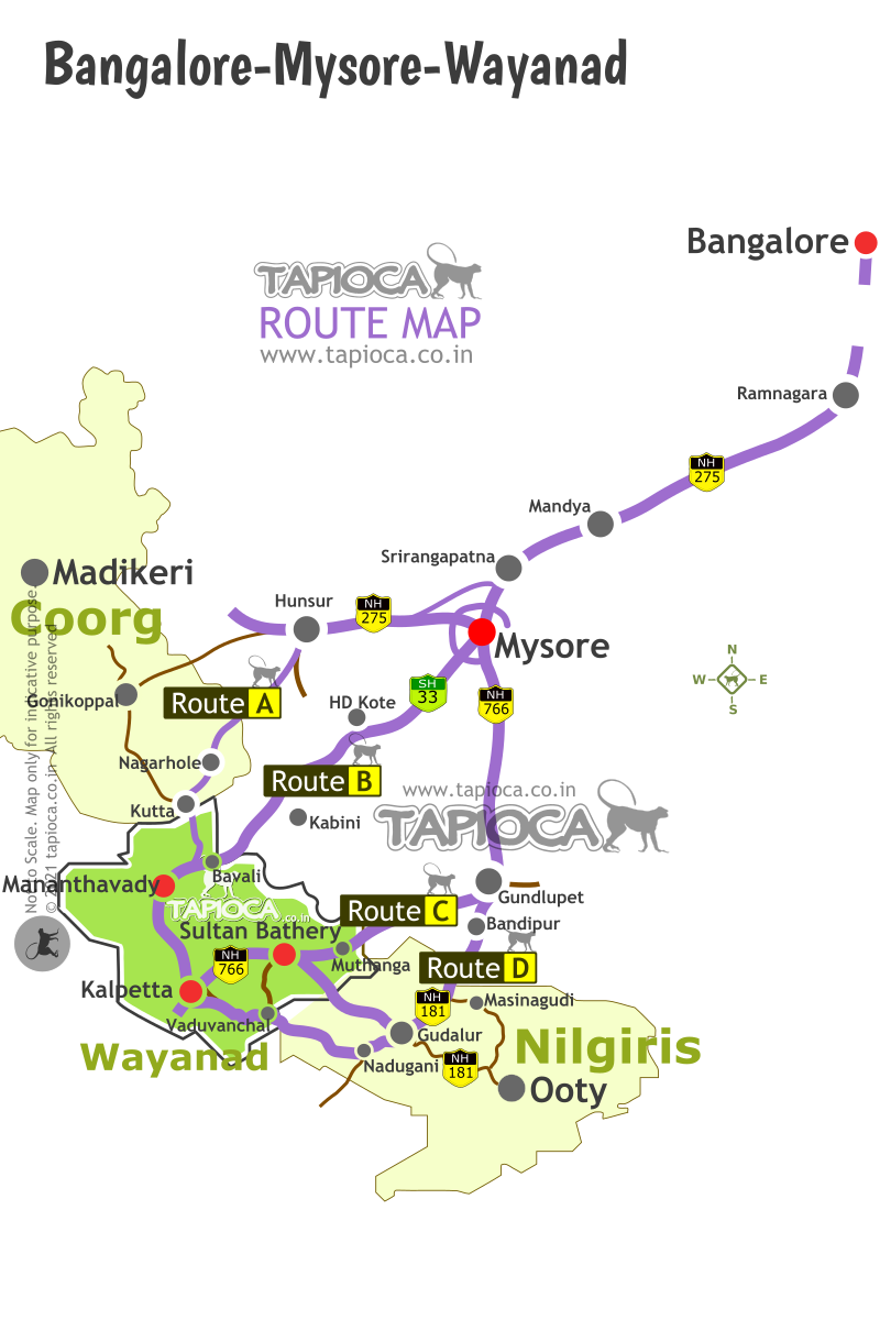
Bangalore to Mananthavady via HD Kote
This route will take you to the northern fringes of Wayanad via Mysore City and Nagarhole forest. The famed Kabini River Lodge, Serai, Kabini and Orange County, Kabini all are located on this route to Wayanad.
Mysore HD Kote Karapura Road to Wayanad
Mysore HD Kote Karapura Road to Wayanad
B
angalore to Wayanad via Mysore and HD Kote is a very favourite among driving fans looking for a scenic route.From the Wayanad itinerary standpoint, select this route among other options ( see Route B in the Bangalore to Wayanad road route map below) if your destination is around the northern part of Wayanad (like Mananthavady, Kuruva, Thirunelli, Pulpally etc).
Bangalore --> 150km --> Mysore -- 50km --> HD Kote (Handpost) -- 24km --> Udbur (forest entry gate) -- 22km --> Bavali (forest exit gate) -- 7km --> Kattikulam -- 10 km --> Mananthavady
Like the Route A & C to Wayanad, the Route B via HD Kote-Nagarhole-Bavali too is in the direction of Mysore from Bangalore.
The Route B is very identical to Route A, to reach Mananthavady from Bangalore. At Mysore, drive right through the city and get to the SH 33 (popularly called the HD Kote road or Mananthavady). For simplicity, let's see the overall Rout B into 6 parts.
1. Getting out of Bangalore city.
2. Bangalore to Mysore drive.
3. Drive through Mysore City.
4. Mysore to HD Kote.
5. HD Kote to Nagarhole forest and Bavali (Karnataka-Kerala border).
6. Bavali to Mananthavady.
Getting out of Bangalore and Drive to Mysore
In about 150km (4 hours), you'll reach the periphery Bangalore. For the Bangalore- Mysore stretch see the Bengaluru-Mysuru route details here.
Inside Mysore city
The road to Mananthavady is at the opposite end of Mysore city when you enter it from Bangalore side.
There is an outer ring road that bypasses Mysore city and connect with the Mananthavadi road. But it's longer route than driving through Mysore city. Unlike Bangalore, traffic inside Mysore city is not hectic.
Either route you chose, the idea is to get to the Mananthavady road at the opposite end of the city.
From the Ring road junction drive straight into Mysore city. A little ahead after the signal you'll see a Y fork. Take the right fork. This is the Banni Mantapa Road. You'll reach a large roundabout after a stadium. Take the right at the roundabout into Sayyaji Rao Road. Further ahead at the next large roundabout turn right towards Mysore Railway station. In front of the railway station the road makes a left turn into JLB Road.
JLB road takes you to the starting point of Mananthavady Road. Turn right into Mananthavadi Road at the roundabout.
If you feel driving through the city looks complicated, take the Outer Ring road before you enter Mysore city. Turn right into the Outer Ring road at the signal where the ring road crosses the highway.
Keep driving on the Outer Ring Road for about 20km, to see the Mananthavady road crossing it. Turn right into Mananthavady Road.
Mysore to HD Kote diversion
In about 1 hour (about 45km) time you can reach Handpost Junction near HD Kote from Mysore city. The highway (SH33) is in great shape all the way.
There is a fuel station at Hand Post junction. From here onwards, till you enter Wayanad 2 Hours/50km you'll be driving through forest and remote villages with no high wayside facilities.
About 15 km after Handpost Junction (HD Kote diversion) you'll reach the entrance of Rajiv Gandhi National park. The traffic through the forest is blocked. You’ll see a closed gate across the highway.
Take the left diversion at the gate. This bypass road goes around the fringes of the forest and many villages like Karapura fringing the forest.
Somewhere on your left you can see the Kabini backwaters at a distance. Your road is also the route for the famous Jungle Lodges in Kabini, Orange County, The Serai Kabini and so on.
The road is narrow but in good condition, as you wiggle through the Karapura village.
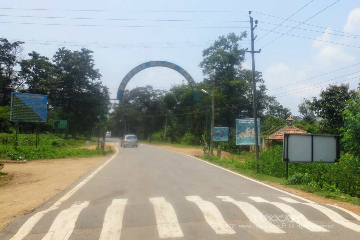
The road re enters the forest at Udbur check post (Opens at 6am and closes at 6pm). You need to give details and sign a register before entering the forest. There is no fee to be paid. A few more kilometers later the so called bad stretch of the road ends and re joins the SH33 inside the forest. Take the left at the junction.
This is one of the dense forests in the region, with highest probability of wildlife spotting. It's not uncommon to spot even tiger on this route, especially during the mornings and evenings. While in the forest follow the cautions and etiquettes. Most importantly, do not park the vehicle and venture out.
Unlike many roads through forests of this region, this road is pretty straight throughout the national park area. Before you exit the national park you would pass a few check posts and many tribal settlements.
At Bavali, you'll exit the national park and enter Wayanad district. A single carriageway bridge marks the Kerala-Karnataka border.
This gate is closed for vehicle entry during night (6pm to 6am).
Bavali to Mananthavady
The forest (Begur Reserve Forest) continues for many kilometers before you reach the Kattikulam town from Bavali.
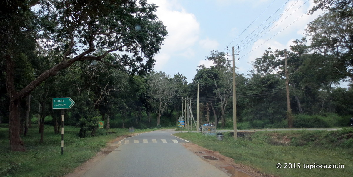
About 5km from Bavali, you'll see the Kuruva Island road on your left. Further 1km ahead, you'll enter Kattikulam town.
Just before the Kattikulam town is the road towards Thirunelly and Tholpetty. This is the junction where the route to Mananthavady via Kutta joins the Mananthavadi road.
Kattikulam is the only place you can find a hotel or a fuel station after you've left the Handpost junction at HD Kote.
Mananthavady is 10 km further on the main road from Kattikulam.
Baring the 12km stretch that is getting damaged progressively over the years, you'll find this route from Bangalore to Mananthavady a pleasure. The drive through the national park is of course a highlight. Very similar to the other routes through the forest, traffic is not allowed in the night (between 6pm and 6am).
Wayanad
Bangalore-Mysore-Coorg-Wayanad-Ooty Route Map
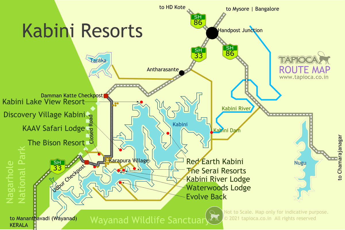
Serai Kabini Route Map from Mysore. From Mysore to Serai distance is 80km
Bangalore to Serai Kabini distance is about 225km.
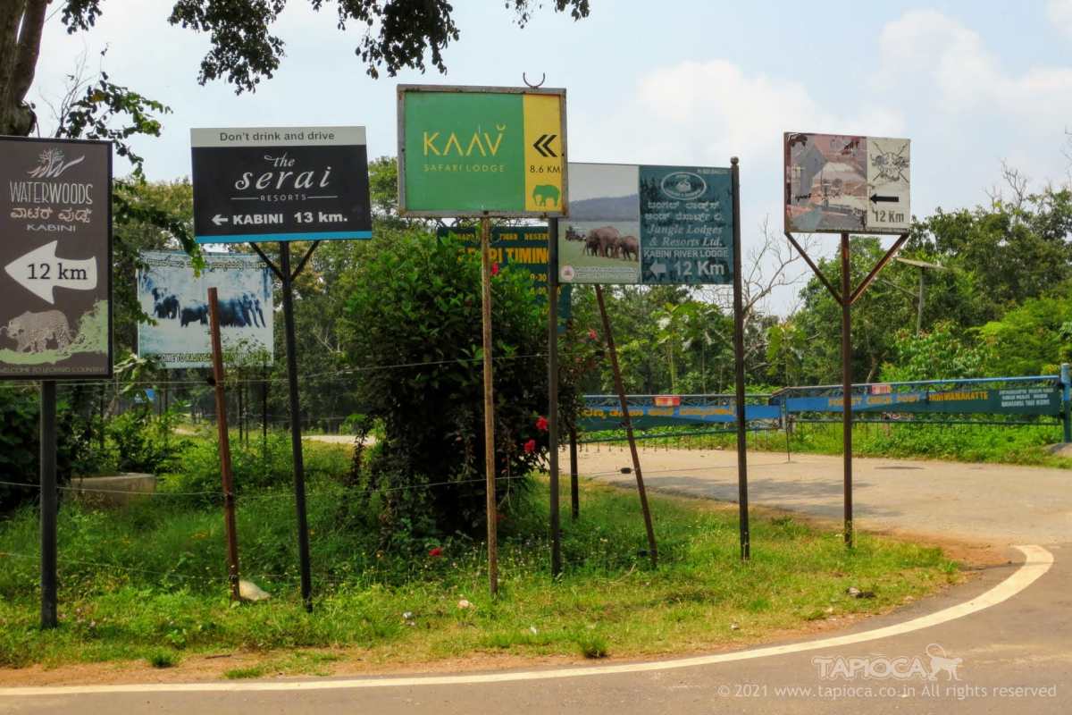
Signages of resorts around Kabini.
Most of these resorts like JLR, Serai, KAAV Safari Lodge are around the Karapura village, so 12km from this diversion. You can also see the closed gate across the road into the Nagarhole forest.
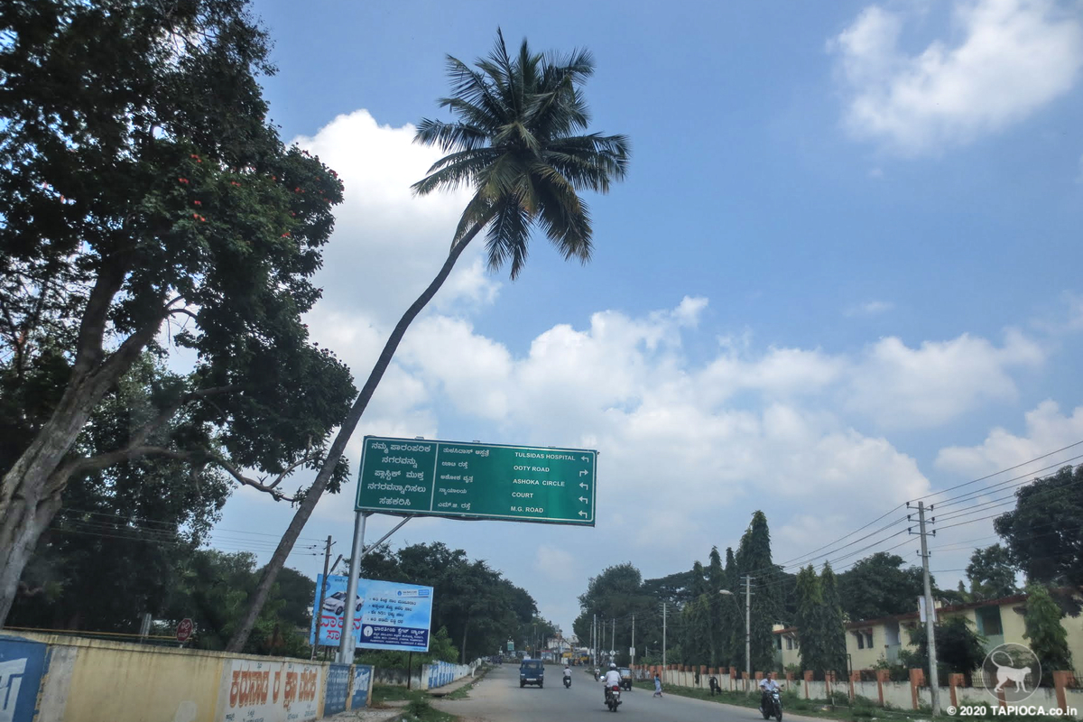
Mananthavady Road in Mysore City
Road to Mananthavady (locally called the HD Kote Road) starts from the north of Mysore city.
Kabini
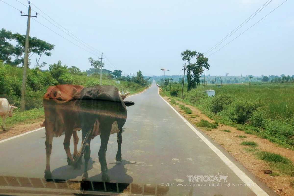
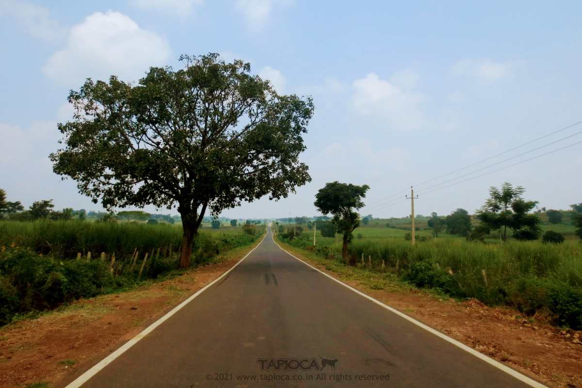
On the way to Wayanad from Mysore via Kabini
Nagarhole
Re entry to Nagarhole at Udbur on the way to Mananthavady.
The Udbur diversion inside Nagarhole forest. While driving from Mananthavady towards Mysore, this diversion bypasses the core part of the Nagarhole forest.
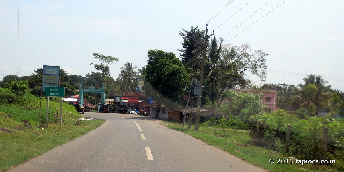
Bavali near Kerala Karnataka border in Wayanad.
Bavali near Kerala Karnataka border in Wayanad.
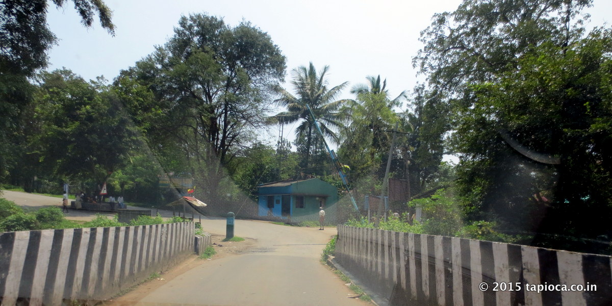
Kerala Karnataka border at Bavali.
This narrow bridge is across the riverlet that marks the state border.

HD Kote road near Mysore
HD Kote road near Mysore
Wayanad
Serai Kabini Route Map from Mysore. From Mysore to Serai distance is 80km
Serai Kabini Route Map
Bangalore to Serai Kabini distance is about 225km.
Signages of resorts around Kabini.
Damman Katte Checkpost Diversion in Nagarhole
Most of these resorts like JLR, Serai, KAAV Safari Lodge are around the Karapura village, so 12km from this diversion. You can also see the closed gate across the road into the Nagarhole forest.
Mananthavady Road in Mysore City
Kabini
Karapura Road
On the way to Wayanad from Mysore via Kabini
Nagarhole
Udbur Checkpost
Re entry to Nagarhole at Udbur on the way to Mananthavady.
The Udbur diversion inside Nagarhole forest. While driving from Mananthavady towards Mysore, this diversion bypasses the core part of the Nagarhole forest.
Udbur Diversion
Bavali near Kerala Karnataka border in Wayanad.
Kerala Karnataka border at Bavali.
Kerala Karnataka Boarder at Bavali
This narrow bridge is across the riverlet that marks the state border.