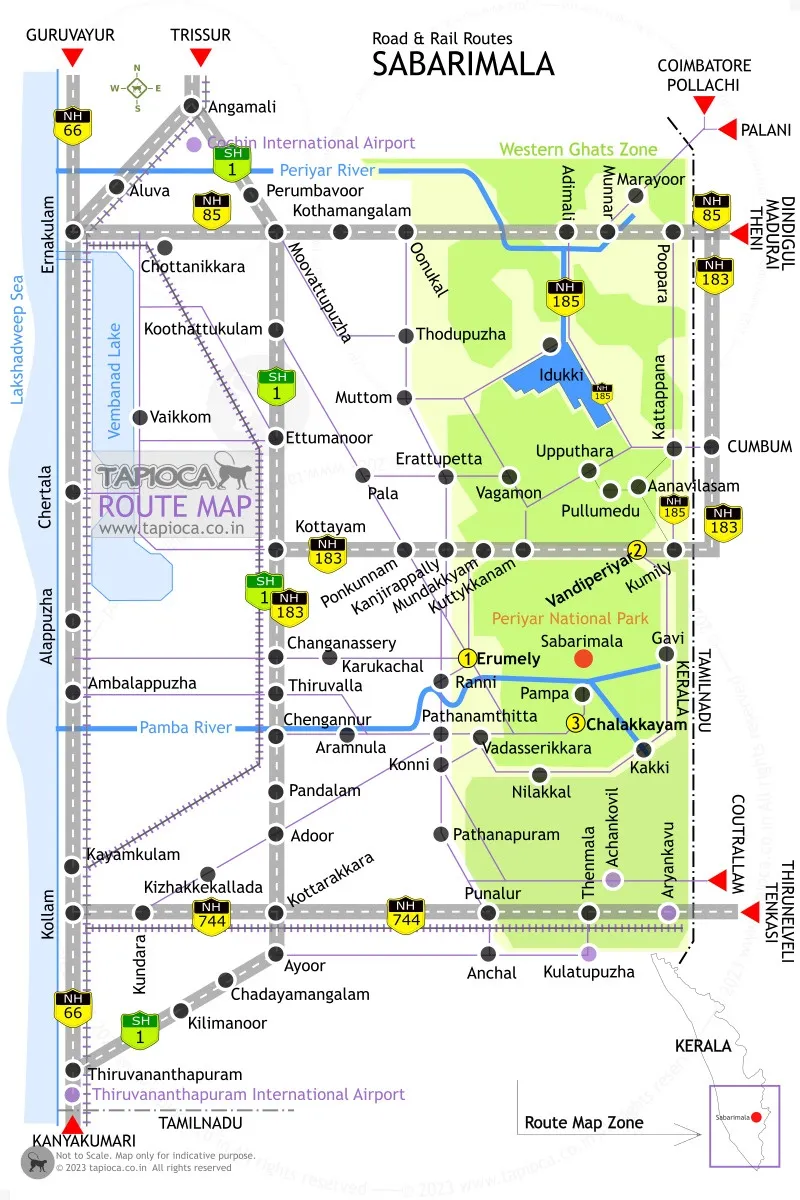
[#road] Erumeli , Vandiperiyar and Chalakayam are the three main entry point to the Pamba route.
For traveling to Sabarimala from places like Kottayam, Ernakulam, Trissur, Mangalore) take the Erumeli route. Erumeli is also the starting point of the traditional longer trek trail to Sabarimala (Periyapatha).
Take the Vandiperiyar route for traveling to Sabarimala from the northeastern side of Sabarimala ( Idukki, Coimbatore , Dindigul, Madurai etc)
Chalakayam route at the south arc acceaable both from Erumeli and Pathanamthitta. From the southwestern districts like Kollam, Thiruvananthapuram, Thirunelveli , Kanyakumari etc take this route.
Once you’ve finalise the entry point, pick suitable route from below to connect…
Major routes are listed with approximate distance to Sabarimala (Pamba) in kilometers. You may even make a custom route by merging parts of different routes below.
See below the map showing the major road network to reach Sabarimala & route selection tips.
…from north Kerala
Routes to consider for Sabarimala from Mangalore, Kasargod, Kannur, Calicut, Malappuram, Mysore , Palghat, Coimbatore).
Route 1: Kasragod → 91km→ Kannur → 134km→ Kottakkal → 75km→ Trissur → 45km→ Angamali → 155km→ Pamba [ Distance : 500km]
Route 2: Kasragod → 91km→ Kannur → 140km→ Tirur → 48km→ Guruvayur→ 83km→ Ernakulam → 145km→ Pamba [ Distance : 507km]
Route 3: Kozhikode→ 47km→ Tirur → 48km→ Guruvayur→ 83km→ Ernakulam → 145km→ Pamba [ Distance : 323km]
Route 4: Kozhikode → 45km→ Kottakkal → 75km→ Trissur → 45km→ Angamali → 155km→ Pamba [ Distance : 320km]
Route 5: Sultan Battery → 24km→ Kalpetta→ 104km→Kottakkal → 75km→ Trissur → 45km→ Angamali → 155km→ Pamba [ Distance : 403km]
Route 6: Mananthavady → 34km→ Kalpetta→ 104km→Kottakkal → 75km→ Trissur → 45km→ Angamali → 155km→ Pamba [ Distance : 413km]
Route 7: Nilambur → 107km→ Trissur → 45km→ Angamali → 155km→ Pamba [ Distance : 307km]
Route 8: Palakkad → 62km→ Trissur → 45km→ Angamali → 155km→ Pamba [ Distance : 262km]
Once you reach Angamali or Ernakulam, select a suitable Sabarimala route options from below .
…from central Kerala
Routes to consider for Sabarimala from Thrissur , Ernakulam , Kottayam etc along the MC Road )
Route 9: Angamali → 32km → Moovattupuzha → 40km → Pala→ 37km → Erumely → 45km →Pampa [ Distance : 155km]
Route 10: Eranakulam → 63km → Pala→ 37km → Erumely → 45km →Pampa [ Distance : 145km]
Route 11: Eranakulam → 15km → Chottanikkara → 24km → Vaikkom → 27km → Ettumanoor → 16 km → Pala→ 37km → Erumely → 45km →Pampa [ Distance : 164km]
Route 12: Marayoor→ 40km →Munnar→ 56km →Neriamangalam→ 32km →Thodupuzha→ 29km →Pala→ 37km → Erumely → 45km →Pampa [ Distance : 239km]
Route 13: Marayoor→ 40km →Munnar→ 59km →Kattappana→ 82km →Mundakkyam→ 23km →Kanamala → 31km →Pampa [ Distance : 235km]
Route 14: Kumily→ 14km →Vandiperiyar→ 54km →Erumely→ 45km →Pampa. ( Distance: 113 km )
Route 15: Kumily→ 14km →Vandiperiyar→ 27km →Gavi→ 67km →Nilakkal→ 18km →Pampa. ( Distance: 126km )
…from south Kerala
Routes From south parts to Sabarimala (Alapuzha, Kottayam, Kollam, Thiruvananthapuram )
Route 16: Kottayam→ 32km → Ponkunnam → 17km → Erumely → 45km →Pampa [ Distance : 94km]
Route 17: Alappuzha→ 28km →Changanassery→ 16km →Karukachal→ 31km →Erumely→45km →Pampa [ Distance : 120km]
Route 18: Alappuzha → 29km →Changanassery → 8km →Thiruvalla → 36km →Vadasserikkara → 54km →Pampa [ Distance : 123km]
Route 19: Alappuzha → 14km →Ambalappuzha→ 26km →Thiruvalla → 9km →Aranmula → 22km →Vadasserikkara → 55km →Pampa[ Distance : 126km]
Route 20: Kottayam → 32km → Ponkunnam → 17km → Erumely→45km →Pampa. [Distance: 94 km ]
Route 21: Kollam → 11km → Kundara → 13km → Kottarakkara → 19km → Adoor → 17km → Pathanamthitta → 10km → Vadasserikkara → 55km → Pampa ( Distance : 125 km)
Route 22: Kollam → 11km → Kundara → 8km → Kizhakkekallada → 21km → Adoor → 17km → Pathanamthitta → 10km → Vadasserikkara → 55km → Pampa ( Distance : 122 km)
Route 23: Thiruvananthapuram → 33km → Kilimanoor → 33km → Kottarakkara → 19km → Adoor → 17km → Pathanamthitta → 10km → Vadasserikkara → 55km → Pampa ( Distance : 167 km)
Route 24: Thiruvananthapuram → 43km → Parippally → 25km → Kottarakkara → 19km → Adoor → 17km → Pathanamthitta → 10km → Vadasserikkara → 55km → Pampa ( Distance : 169 km)
Route 25: Aryankavu → 13km →Thenmala→ 20km →Punalur→13km →Pathanapuram→ 17km →Konni→ 17km →Vadasserikkara→ 55km →Pampa. ( Distance: 135km )
Route 26: Aryankavu → 13km →Thenmala→ 10km →Kulatupuzha→20km →Anchal→24km →Kottarakkara → 19km → Adoor → 17km → Pathanamthitta → 10km → Vadasserikkara → 55km → Pampa ( Distance : 168 km) . Also see the Achankovil route
Route 27: Chenganoor – Aranmula – Thekkemala – Pathanamthitta – Pampa. ( Distance: 95 km )
Route 28: Chenganoor – Aranmula – Ranni Blockupadi – Vadasserikkara – Pampa. ( Distance: 90km )
Erumeli to Pampa Routes.
Route 29: Erumely – Karinkallum – Moozhiyar- Thulappally – Plappally – Pampa. ( Distance: 60 km )
Route 30: Erumely – Mukkada – Athikkayam – Perunadu – Pamba. ( Distance: 65 km )
Route 31: Erumely – Vechuchira – Athikkayam – Perunadu – Pamba. ( Distance: 60 km )
Route 32: Erumely – Plachery – Chethonkara – Athikkayam – Perunadu – Pamba. ( Distance: 70 km)
Driving Route for Sabarimala from Tamil Nadu and Karnataka
Some of the major entry towns are listed from north to south
Karnataka : Kasargod, Iritty, Mananthavadi, Sultan Battery (Karnataka to Sabarimala Routes)
Tamilnadu : Nilambur, Palakkad, Kollengode, Munnar , Kumily, Thenmala, Thiruvananthapuram
Once you finalise the entry point, connect it with one of the many routes listed above. If you are not sure of the right entry points ,see the routes & route maps to enter Kerala from Karnataka, Tamilnadu.
Bangalore to Sabarimala Distance : 600km
Hyderabad to Sabarimala Distance : 1200km
Madurai to Sabarimala Distance : 250km
The quality of the roads varies, but generally they get maintained before the start of pilgrimage season, especially the roads heading to Pampa in the Ghat Section.
Factors to consider
[#car]Some go for the shortest distance road while other prefer a more comfortable or less traffic to drive road, even though it means a bit longer driving time.
It is typical that pilgrims plan the visit to Sabarimala with visiting of many temples on the way, especially pilgrims coming from far places. See a list popular pilgrimage sites and Temples in Kerala (list north to south)
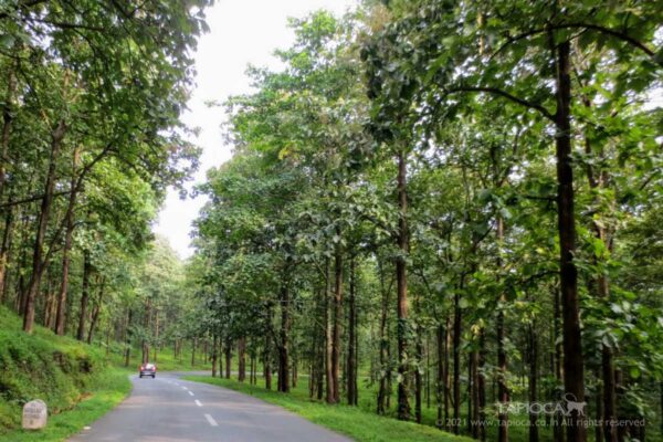
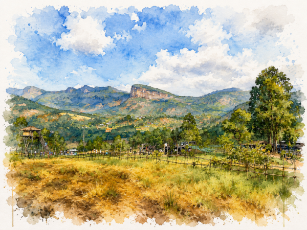
Sabarimala is in the Western Ghats ( forest & mountain region). Any route you take, the last 50-100km will be relatively narrower, curvy and through hilly terrain.
If you are entering Kerala thru the eastern borders ( from Karnataka or Tamilnadu), you’ll have to cross a mountainous region ( Western Ghats).
The relatively plane roads to enter Kerala are through Mangaluru (north), Palakkad (east) and Thiruvananthapuram ( south).
On Kerala roads, consider you can cover 45-50km in a hour.
During the peak Sabarimala pilgrimage season, traffic get diverted. Parking will be allowed only at a point many kilometers before Pamba.
Consider train option to travel to Sabarimala from far places (500+ km) like north part of Kerala , Karnataka, Andhra, Telangana, Tamilnadu etc
consider flight option to Sabarimala from other cities in India. Cochin and Trivandrum are the nearest airports.

Continue Exploring
Alleppey vs Kumarakom
Choosing between Alleppey (Alappuzha) and Kumarakom depends on the kind…
Kanthalloor and Marayoor
Kanthalloor and Marayoor are neighboring hill stations in Kerala’s Idukki…
Why Visit Kanthalloor
Kanthalloor's mountains and fertile valleys, where open landscapes, cool mountain…
Kochi or Kozhikode? Choosing Your Best Kerala Tour Base
Both cities sit on Kerala’s coast and both have airports,…